Map

The New York Real Estate Brochure Collection, housed in Avery Architectural & Fine Arts Library's Classics Department , consists of over 9,200 advertising brochures, floor plans, price lists, and related materials that document residential and commercial real estate development in the five boroughs of New York and outlying vicinities from the 1920s to the 1970s. The majority of the collection is offerings for apartment and other residential spaces. This collection of ephemeral advertising material constitutes an invaluable resource for researching New York City architecture. The brochures and related materials provide architects' and agents' names, illustrate interior and exterior views of buildings, display typical floor plans, and list prominent features of the buildings.

The Harvard Map Collection is one of the oldest and largest collections of cartographic materials in the United States with over 500,000 items. Resources range from 16th century globes to modern maps and geographic information systems (GIS) layers. A selection of our materials has been digitally imaged and is offered both as true picture images and georeferenced copies. This Virtual Collection includes those maps and atlases that are available through the Harvard Image Delivery Service. Those maps that have been georeferenced are available through the Harvard Geospatial Library. Therefore, many of the maps listed will have two records, one for the image that is true to the original and the other a georeferenced image.

The fourth in a series of online collections from Harvard University, Expeditions and Discoveries delivers maps, photographs, and published materials, as well as field notes, letters, and a unique range of manuscript materials on selected expeditions between 1626 and 1953. The collection is made possible with the generous support of the Arcadia Fund . In the 19th and 20th centuries, Harvard University played a significant role—as underwriter, participant, collector, and repository—for pace-setting expeditions around the world. For Internet users, Expeditions and Discoveries provides selective access to Harvard’s multidisciplinary records of those expeditions.
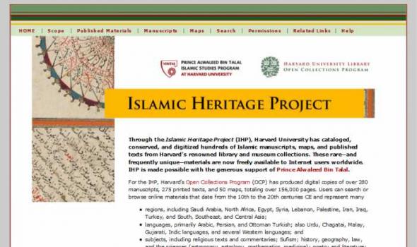
Through the Islamic Heritage Project (IHP), Harvard University has cataloged, conserved, and digitized hundreds of Islamic manuscripts, maps, and published texts from Harvard’s renowned library and museum collections. These rare—and frequently unique—materials are now freely available to Internet users worldwide. IHP is made possible with the generous support of Prince Alwaleed Bin Talal . For the IHP, Harvard’s Open Collections Program (OCP) has produced digital copies of over 280 manuscripts, 275 printed texts, and 50 maps, totaling over 156,000 pages. Users can search or browse online materials that date from the 10th to the 20th centuries CE and represent many

About The Collection The Speculum Romanae Magnificentiae is a collection of engravings of Rome and Roman antiquities, the core of which consists of prints published by Antonio Lafreri and gathered under a title page he printed in the mid-1570's. Copies of the Speculum vary greatly in the number of prints, and individual prints were reissued and changed over time. The University of Chicago Library's copy of the Speculum Romanae Magnificentiae contains nearly 1,000 prints and is the largest in the world. The Library's copy arrived in the 1890's as a part of the Berlin Collection, a large lot of books and manuscripts purchased for the Library from S. Calvary and Co. in Berlin.

About the Collection The First American West presents a digital resource created from selections drawn from the collections of the Filson Historical Society and the University of Chicago. Each of these institutions has realized the critical role that primary source material plays in the research and teaching of history. The First American West draws on the interconnected holdings of the two institutions to create an integrated collection that preserves critical primary sources and presents a fuller and more diverse picture of the exploration and settlement of the trans-Appalachian west. The Filson Historical Society's origins and the University of Chicago's holdings on the trans-Appalachian west both have their roots in the activities of Reuben T. Durrett (1824-1913).

- Auto Club Collection Description The Automobile Club of Southern California Digital Archive provides documentation on the region's transportation history, expecially Los Angeles from 1892 to 1963, from the Auto Club's Corporate Archives. The Digital Archive includes: a selection of 98 historic strip maps, illustrating the development of major Southern California routes; 498 photographs from the general photograph collection, depicting buildings, businesses, streets, and points of interest; and 650 photographs from engineering notebooks along with searchable transcriptions of the engineers' notes documenting the conditions of streets, highways, bridges, railroads, etc.

Project Background This Pilot Project was first conceived in May 1999 to provide Web access to high use maps from the University of California-Berkeley's Earth Sciences and Map Library's collection. One-time funds were requested and received from the Library's collections budget to cover scanning and other project costs. The U.S. Geological Survey's topographic quadrangles of the San Francisco Bay region were selected for digitizing. These maps are in the Public Domain and have no copyright restrictions, plus the geographic area selected would be a high use to our primary clientele and of interest for off-site users. Access is provided to both the 15- and 7.5-minute USGS topographic quadrangles, spanning more than 100 years of mapping (1885-1999). Geographic coverage extends from Pt.

About LA as Subject L.A. as Subject is a research alliance dedicated to preserving and improving access to the raw material of Los Angeles history. Much of the city’s history is preserved in libraries, museums, and other cultural institutions. Other valuable and unique collections – those that reveal the stories of neighborhoods, families, and influential Angelenos – are scattered across Southern California, curated by smaller institutions and individual enthusiasts. With an online directory of more than 230 separate collections, L.A. as Subject ensures that researchers know what materials are available, where they are located, and how to access them. L.A.

For hundreds of years, Scots have left their homeland to set up a new life overseas.
Here we tell six stories of emigration from Scotland between the 1770s and the 1930s:
* Flora MacDonald – of 'Bonnie Prince Charlie' fame – and her husband Allan from Skye
* John and Mary Salmond from Montrose
* John and Martha Kerr from Dalry
* Peter Hastie from Edinburgh
* Alexander MacArthur from Nairn
* George Anderson from Innerleithen
* George and Jane Oliver from Hawick.
Original letters and journals
Using letters, journals, official documents, photographs and maps from the National Library of Scotland's archives, we piece together a picture of Scots abroad.

About 'Maps of Scotland' In our 'Maps of Scotland' resource you can access and view over 20,000 maps as high-resolution, colour, zoomable images. The maps date between 1560 and 1935 and we have grouped them into several categories. Browse by category The easiest way of finding material is to browse by category . The maps vary in the amount of detail they offer: You can also browse the maps by the names of map-makers, surveyors and engravers . Sets of county maps We have several altases online with sets of county maps : Military maps Another category is of maps made for military purposes , especially those from the 18th century. These include the famous Roy Military Survey of Scotland .

The Medical History of British India collection consists of official publications varying from short reports to multi-volume histories related to disease, public health and medical research between circa 1850 to 1920. These documents form invaluable source material for the reconstruction of the history of disease and medicine in British India. Although a large section of it has an all-India scope, the collection is especially rich in documents related to Bombay and the Punjab. The Bombay plague of 1896-1899, one of the severest outbreaks, is particularly well covered.

Golf in Scotland: A swing through time
The origins of golf are a matter of mystery and controversy.
Shown here are some of the earliest sources for the history of golf in Scotland. They shed light on the birth of the game, its language, techniques and equipment.
Social side of golf
They also tell us much about the social standing of golf as it developed from an outlawed activity to the world's most internationally important game.
World's first golf club
Documents and texts from the National Library of Scotland's collections and other sources give an insight into the early days of the game.

Mapmaking and printing from 1820 to 2002
The Bartholomew Archive is the remarkable record of the Edinburgh-based firm of map engravers, printers and publishers, John Bartholomew & Son Ltd. It is one of the most extensive cartographic archives available for research in a public institution.
Members of the Bartholomew family were engaged in map-making from the first known map engraving work of George Bartholomew in 1825. John Bartholomew junior started printing operations before 1870. For more than a century afterwards the Bartholomew firm specialised in high-quality map production.
Importance of the archive
The Bartholomew Archive enables us to:

We can trace Scottish printing back to 4 April 1508.
On that date the earliest surviving dated book in Scotland was printed in Edinburgh.
Here you can read full texts of items printed on 33 of the first 38 printing presses set up in Scotland between 1508 and 1900. These have been digitised from the National Library of Scotland's collections.
They include that first dated printed book – see The Complaint of the Black Knight, printed by Chepman and Myllar.
You can also trace the geographical spread of printing in Scotland, from the first printing towns to the 'printing revolution' in the 19th century.

The Michigan County Histories and Atlases Digitization Project is comprised of 428 digitized titles (many composed of multiple volumes) published before 1923. The collection offers all members of the community free keyword searching and page-by-page access to digitized reproductions of Michigan county histories and atlases as a resource for historical and genealogical research. The collection is made possible, in part, through a generous Library Services and Technology Act (LSTA) grant. Additional funding was provided by Michigan Council of Library Directors institutions and a Michigan Digitization and Preservation for Access grant.

Polar Bear Expedition Digital Materials Because many of the American troops involved in the intervention were from Michigan, the Bentley Historical Library Michigan Historical Collections has long been interested in documenting this episode. This collection contains digitized versions manuscripts and photographs as well as maps and primary printed source materials relating to the Polar Bear Expedition. The primary guide to the Polar Bear Expedition collections held by the Bentley Historical Library can be found here: Polar Bear Expedition Digital Collections .

The Built Heritage of North Carolina "The Built Heritage of North Carolina" provides access to documentation on hundreds of buildings and structures in North Carolina dating from the 1700s to the early 1900s. Buildings represented in this project include well-known examples of historic architecture, such as Baldhead Lighthouse, the Bellamy Mansion in Wilmington, and Blandwood in Greensboro. Also covered are such lesser known but historically significant structures as the Jordan House in Bertie County (one of the earliest brick buildings in the state) and the Allison-Deaver House in Transylvania County (one of the oldest frame dwellings west of the Blue Ridge).

Scope and Content Images of Russia and Caucasus Region 1929-1933 presents over 700 images of Russia and the central Caucasus including the Republic of Georgia and Dagestan from the William O. Field Collection housed at the American Geographical Society Library. The photographic collection is supplemented by Field's diaries and travel notes, and a selection of maps of the Caucasus region. William O. Field (1904 - 1994), geographer, pioneer glaciologist, and a member of the American Geographical Society visited the Soviet Union three times between 1929 and 1933. During his first trip in 1929, Field traveled to Svanetia, a remote region in Georgia, located in the southern part of the Central Caucasus.

Scope and Content The Digital Sanborn Maps of Milwaukee 1894 & 1910 brings online 2 fire insurance atlases featuring detailed color maps of Milwaukee. Produced by the Sanborn Map Company, the 1894 atlas includes four volumes, consisting of 450 map sheets and the 1910 atlas includes eight volumes, consisting of 830 map sheets. Sanborn maps were designed to assist fire insurance agents with insuring property. Produced for over 12,000 urbanized areas in the United States, Sanborn maps have been described by the Library of Congress as "the single most important record of urban growth and development in the United States during the past one hundred years." Sanborn maps are excellent historical resources for academic, professional and personal needs.

Scope and Content This digital collection presents a selection of historical maps and photographs of Tibet from the holdings of the American Geographical Society (AGS) Library. The collection consists of 1,090 images. It includes a unique set of 50 photographs of central Tibet and Lhasa taken by two Mongolian Buddhists, G. Ts. Tsybikoff and Ovshe Norzunoff, who visited Tibet in 1900 and 1901. The photographs represent the first photographic images of Potala Palace in Lhasa and other Tibetan monasteries. In addition, over 1,000 images of Tibet have been drawn from the extensive photographic collection of Harrison Forman. Photojournalist and explorer, Forman undertook three expeditions to remote areas of northern Tibet between 1932 and 1937.

About the Collection Milwaukee and Art Work of Milwaukee Milwaukee Neighborhoods: Photos and Maps 1885 - 1992 presents images of Milwaukee neighborhoods from the Far Northwest Side to the Far South Side. The selection of images is limited by the current boundaries of the city of Milwaukee. The digital collection provides a visual documentation of the development of the city of Milwaukee from the mid-1880s to the early 1990s. It includes images of residential and industrial facilities, local businesses, historic buildings, churches, and numerous Milwaukee parks.

The Theater that was Rome About From the sixteenth through the eighteenth centuries, when the books, maps and single sheet prints that appear on this web site were made, Rome presented itself as a theater of the most advanced engineering feats of the period, as well as of the technological skills to execute and record the decorative programs that went with them. Maps of the city in its new guise as the powerful center of Christendom also documented the growth of curiosity about its antique history and pagan past, displaying all the forms of cartographic knowledge available throughout the period.

Visit Cowpaths (opens a new window) View all Boston Streets images (Using the Tufts Digital Library) Browse all Boston city atlases (Using the Tufts Digital Library) The Project: Boston Streets: Mapping Directory data was developed by the Digital Collections and Archives, Tufts University, with support from a National Leadership Grant from the Institute of Museum and Library Services . Additional support was provided by Docema, The Bostonian Society , and other anonymous gifts. The Bostonian Society provided more than 3000 images to the project and was also a major partner in developing descriptive cataloging specifications.

About Oregon Maps The University of Oregon Libraries and the Oregon State University Libraries present the Oregon Maps online collection in celebration of Oregon's sesquecentennial. Whether traveling city streets and country roads, or observing forests and farms from an airplane window, the patterns of the landscape have come to resemble the maps we draw. As European settlers populated Oregon, Western traditions of cartography came as well. One hundred and fifty years later, the Jeffersonian survey grid is imprinted in everyone's mind as most of Oregon's roads and property boundaries have been drawn on top of our Public Land Survey System. Maps are not simple representations of the world.

Oregon Explorer is a comprehensive digital library of Oregon's natural resources. This state-of-the-art, Web-based resource uses advanced information technology to access and integrate data from state and federal agencies, local governments, university scientists, citizens, and K-12 educators and students. It supports informed decisions and actions by people concerned with Oregon's natural resources and environment.
Through a series of geographic, data and topic-based Web portals, Oregon Explorer helps users:

FAQ Local and Regional Documents Archive About This Project The Local and Regional Documents Archive is a service of the University of Oregon Libraries. The project seeks to serve the citizens of Oregon and researchers around the world by providing a central repository and archive of significant documents produced by local governments and regional offices of United States federal government agencies within the state. Governments and agencies represented in the database include: Among the types of documents included in the archives are local planning documents, city development codes, sub-area plans, documents required by the National Environmental Policy Act (NEPA), land management planning documents, resource management plans, and environmental opinions.

About - Columbia River Basin Project Background The University of Oregon Libraries are participating in a collaborative project to develop a digital collection of print, image, cartographic, and other format materials relating to the waters of the Western United States. The project is partially funded by a grant from the Institute of Museum and Library Services (IMLS) and is administered centrally by the Greater Western Library Alliance (GWLA) of which the UO Libraries are a member. The Western Waters Digital Library (WWDL) is a distributed collection of materials from research institutions in the Western United States of America.

CUGIR: Cornell University Geospatial Information Repository About the Cornell University Geospatial Information Repository (CUGIR) CUGIR is an active online data and metadata repository and a participating node in the National Spatial Data Infrastructure program. CUGIR provides open and free access to geospatial data and metadata for New York State, with special emphasis on natural features relevant to agriculture, ecology, natural resources, and human-environment interactions. Subjects such as landforms and topography, soils, hydrology, environmental hazards, agricultural activities, wildlife and natural resource management are appropriate for inclusion in the CUGIR catalog.

This collection consists of digitally reproduced images of paper maps from the Cornell University Library's Map Collection. Included are maps from locations around the world, ranging in date from the nineteenth century to the present. While this collection will continue to grow, it will still only represent a fraction of the 300,000 maps, atlases, and other forms of geospatial data that make up the Map Collection. Located in Olin Library, the Map Collection is open to the public.


