Geography & Maps
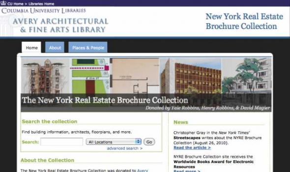
The New York Real Estate Brochure Collection, housed in Avery Architectural & Fine Arts Library's Classics Department , consists of over 9,200 advertising brochures, floor plans, price lists, and related materials that document residential and commercial real estate development in the five boroughs of New York and outlying vicinities from the 1920s to the 1970s. The majority of the collection is offerings for apartment and other residential spaces. This collection of ephemeral advertising material constitutes an invaluable resource for researching New York City architecture. The brochures and related materials provide architects' and agents' names, illustrate interior and exterior views of buildings, display typical floor plans, and list prominent features of the buildings.
The Harvard Map Collection is one of the oldest and largest collections of cartographic materials in the United States with over 500,000 items. Resources range from 16th century globes to modern maps and geographic information systems (GIS) layers. A selection of our materials has been digitally imaged and is offered both as true picture images and georeferenced copies. This Virtual Collection includes those maps and atlases that are available through the Harvard Image Delivery Service. Those maps that have been georeferenced are available through the Harvard Geospatial Library. Therefore, many of the maps listed will have two records, one for the image that is true to the original and the other a georeferenced image.

The fourth in a series of online collections from Harvard University, Expeditions and Discoveries delivers maps, photographs, and published materials, as well as field notes, letters, and a unique range of manuscript materials on selected expeditions between 1626 and 1953. The collection is made possible with the generous support of the Arcadia Fund . In the 19th and 20th centuries, Harvard University played a significant role—as underwriter, participant, collector, and repository—for pace-setting expeditions around the world. For Internet users, Expeditions and Discoveries provides selective access to Harvard’s multidisciplinary records of those expeditions.

The Mercator Globes Gerard Mercator was a publisher of maps and atlases but he also published two globes — the terrestrial globe of 1541 and the celestial globe of 1551. The globes were an instant commercial success and were the largest (42 cm) that had been produced to date. This online exhibit allows the viewer to study detailed images for each of the globes. The globes are now on permanent exhibit just outside of the entrance to the Map Collection in Pusey Library. Viewing Features of the Exhibition This exhibition offers a unique approach for viewing each globe.
About the Collection The First American West presents a digital resource created from selections drawn from the collections of the Filson Historical Society and the University of Chicago. Each of these institutions has realized the critical role that primary source material plays in the research and teaching of history. The First American West draws on the interconnected holdings of the two institutions to create an integrated collection that preserves critical primary sources and presents a fuller and more diverse picture of the exploration and settlement of the trans-Appalachian west. The Filson Historical Society's origins and the University of Chicago's holdings on the trans-Appalachian west both have their roots in the activities of Reuben T. Durrett (1824-1913).
- Auto Club Collection Description The Automobile Club of Southern California Digital Archive provides documentation on the region's transportation history, expecially Los Angeles from 1892 to 1963, from the Auto Club's Corporate Archives. The Digital Archive includes: a selection of 98 historic strip maps, illustrating the development of major Southern California routes; 498 photographs from the general photograph collection, depicting buildings, businesses, streets, and points of interest; and 650 photographs from engineering notebooks along with searchable transcriptions of the engineers' notes documenting the conditions of streets, highways, bridges, railroads, etc.

Project Background This Pilot Project was first conceived in May 1999 to provide Web access to high use maps from the University of California-Berkeley's Earth Sciences and Map Library's collection. One-time funds were requested and received from the Library's collections budget to cover scanning and other project costs. The U.S. Geological Survey's topographic quadrangles of the San Francisco Bay region were selected for digitizing. These maps are in the Public Domain and have no copyright restrictions, plus the geographic area selected would be a high use to our primary clientele and of interest for off-site users. Access is provided to both the 15- and 7.5-minute USGS topographic quadrangles, spanning more than 100 years of mapping (1885-1999). Geographic coverage extends from Pt.
American Journeys contains more than 18,000 pages of eyewitness accounts of North American exploration, from the sagas of Vikings in Canada in AD1000 to the diaries of mountain men in the Rockies 800 years later. Read the words of explorers, Indians, missionaries, traders and settlers as they lived through the founding moments of American history. View, search, print, or download more than 150 rare books, original manuscripts, and classic travel narratives from the library and archives of the Wisconsin Historical Society. To get started, simply select an activity on the toolbar above. Funded by the U.S. Institute of Museum & Library Services and by private donors, American Journeys is a collaborative project of the Wisconsin Historical Society and National History Day.
About LA as Subject L.A. as Subject is a research alliance dedicated to preserving and improving access to the raw material of Los Angeles history. Much of the city’s history is preserved in libraries, museums, and other cultural institutions. Other valuable and unique collections – those that reveal the stories of neighborhoods, families, and influential Angelenos – are scattered across Southern California, curated by smaller institutions and individual enthusiasts. With an online directory of more than 230 separate collections, L.A. as Subject ensures that researchers know what materials are available, where they are located, and how to access them. L.A.

Old China Hands Archive Who is an "Old China Hand" and what is the "Old China Hand Experience?" According to A Concise Dictionary of Slang and Unconventional English, edited by Paul Beale, (Macmillan, 1989), this term has been in use since approximately 1910 and is applied to "One who has spent many years in China in the commercial or civil service, or as a missionary." The dictionary's definition leaves out some important categories of people, particulary the waves of refugees from the conflicts of Europe and elsewhere who found temporary shelter in China, as well as people who served in the military of many nations. It must also be expanded to point out that implicit in the term is the notion of contact between Chinese and non-Chinese cultures.

An image database of historically significant documents, manuscripts, photographs and related graphic materials from public and private collections in the San Fernando Valley. It provides full, open and equal access to materials demonstrating the socio-economic changes and cultural evolution of the San Fernando Valley from the early 19th century through the end of the 20th century.
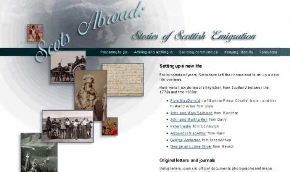
For hundreds of years, Scots have left their homeland to set up a new life overseas.
Here we tell six stories of emigration from Scotland between the 1770s and the 1930s:
* Flora MacDonald – of 'Bonnie Prince Charlie' fame – and her husband Allan from Skye
* John and Mary Salmond from Montrose
* John and Martha Kerr from Dalry
* Peter Hastie from Edinburgh
* Alexander MacArthur from Nairn
* George Anderson from Innerleithen
* George and Jane Oliver from Hawick.
Original letters and journals
Using letters, journals, official documents, photographs and maps from the National Library of Scotland's archives, we piece together a picture of Scots abroad.
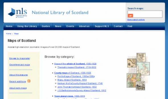
About 'Maps of Scotland' In our 'Maps of Scotland' resource you can access and view over 20,000 maps as high-resolution, colour, zoomable images. The maps date between 1560 and 1935 and we have grouped them into several categories. Browse by category The easiest way of finding material is to browse by category . The maps vary in the amount of detail they offer: You can also browse the maps by the names of map-makers, surveyors and engravers . Sets of county maps We have several altases online with sets of county maps : Military maps Another category is of maps made for military purposes , especially those from the 18th century. These include the famous Roy Military Survey of Scotland .
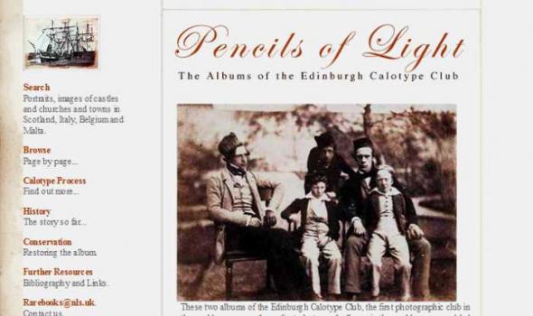
These two albums of the Edinburgh Calotype Club, the first photographic club in the world, are among the earliest photograph albums in the world ever assembled. They contain over 300 images by a group of pioneering Scottish photographers working in Edinburgh and St. Andrews.

Mapmaking and printing from 1820 to 2002
The Bartholomew Archive is the remarkable record of the Edinburgh-based firm of map engravers, printers and publishers, John Bartholomew & Son Ltd. It is one of the most extensive cartographic archives available for research in a public institution.
Members of the Bartholomew family were engaged in map-making from the first known map engraving work of George Bartholomew in 1825. John Bartholomew junior started printing operations before 1870. For more than a century afterwards the Bartholomew firm specialised in high-quality map production.
Importance of the archive
The Bartholomew Archive enables us to:
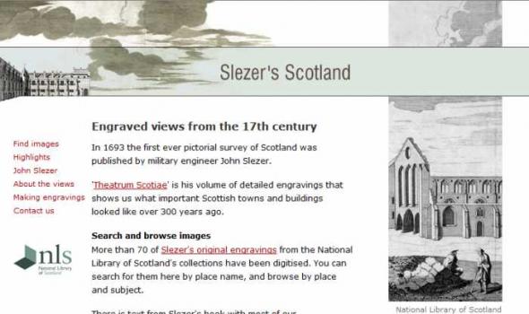
In 1693 the first ever pictorial survey of Scotland was published by military engineer John Slezer.
'Theatrum Scotiae' is his volume of detailed engravings that shows us what important Scottish towns and buildings looked like over 300 years ago.
Search and browse images
More than 70 of Slezer's original engravings from the National Library of Scotland's collections have been digitised. You can search for them here by place name, and browse by place and subject.
There is text from Slezer's book with most of our zoom-and-pan images, and we give links to relevant online maps.

The Kirk Papers is a collection of photographs and papers belonging to East Africa pioneer Sir John Kirk. It was acquired for the National Library of Scotland in 1998/1999 with the help of a grant of £55,000 from the Heritage Lottery Fund.
Though not as well-known as his friend and fellow-explorer David Livingstone, Kirk was a trail-blazer of empire in East Africa and a man of eminence in his day. Born in Barry, Angus, in 1832, Kirk qualified in medicine at Edinburgh University and then volunteered for medical service in the Crimea. An accomplished botanist, zoologist and diplomat, he was also a talented photographer. This is evident from the collection of over 250 photographs, many of them stunning.
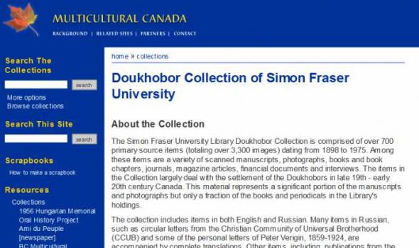
Doukhobor Collection of Simon Fraser University About the Collection The Simon Fraser University Library Doukhobor Collection is comprised of over 700 primary source items (totaling over 3,300 images) dating from 1898 to 1975. Among these items are a variety of scanned manuscripts, photographs, books and book chapters, journals, magazine articles, financial documents and interviews. The items in the Collection largely deal with the settlement of the Doukhobors in late 19th - early 20th century Canada. This material represents a significant portion of the manuscripts and photographs but only a fraction of the books and periodicals in the Library's holdings. The collection includes items in both English and Russian.
Introduction The Ann Arbor District Library, the University of Michigan University Library and the U-M’s Bentley Historical Library have entered into a partnership to create The Making of Ann Arbor, an online, public website on the history and development of the Ann Arbor community. MOAA is an illustrated narrative about Ann Arbor from its pioneer days when it was part of Michigan Territory to the early twentieth century. The project draws upon the three libraries’ resources and the expertise of all three partners to build a website of interest to the citizens of Ann Arbor. In addition to the illustrated narrative history of our city, the website has a searchable image database, including many photographs and other visual images not used in the narrative.

aking of America (MOA) represents a major collaborative endeavor to preserve and make accessible through digital technology a significant body of primary sources related to development of the U.S. infrastructure. With funding from the Andrew W. Mellon Foundation , MOA seeks to involve research institutions and national consortia to develop common protocols and consensus for the selection, conversion, storage, retrieval, and use of digitized materials on a large, distributed scale. The initial phase of the project, begun in the fall of 1995, focused on developing a collaborative effort between the University of Michigan and Cornell University .

The Michigan County Histories and Atlases Digitization Project is comprised of 428 digitized titles (many composed of multiple volumes) published before 1923. The collection offers all members of the community free keyword searching and page-by-page access to digitized reproductions of Michigan county histories and atlases as a resource for historical and genealogical research. The collection is made possible, in part, through a generous Library Services and Technology Act (LSTA) grant. Additional funding was provided by Michigan Council of Library Directors institutions and a Michigan Digitization and Preservation for Access grant.
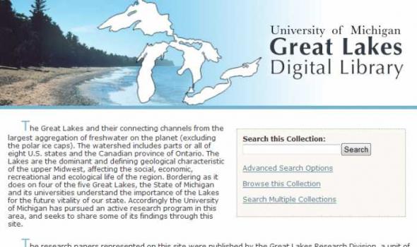
The Great Lakes and their connecting channels from the largest aggregation of freshwater on the planet (excluding the polar ice caps). The watershed includes parts or all of eight U.S. states and the Canadian province of Ontario. The Lakes are the dominant and defining geological characteristic of the upper Midwest, affecting the social, economic, recreational and ecological life of the region. Bordering as it does on four of the five Great Lakes, the State of Michigan and its universities understand the importance of the Lakes for the future vitality of our state. Accordingly the University of Michigan has pursued an active research program in this area, and seeks to share some of its findings through this site.

Comments to: UMDL Help About the collection This project is comprised of texts which were digitized in two groups. The first group contains four accounts of travel in southeastern Europe, each of which contains a significant portion devoted to Bosnia and Hercegovina. The texts were chosen because they were not copyright restricted, had coverage that fit the above profile, and duplicated holdings in University of Michigan Library's collection, which were either copies or microfilms. The four texts are: Bosnie et Herzegovin: Souvenirs de Voyage pendant l'Insurrection, by Charles Yriarte, published in Paris by E. Plon et Cie, 1876; Dalmatia: the Land Where East Meets West, by Maude M.
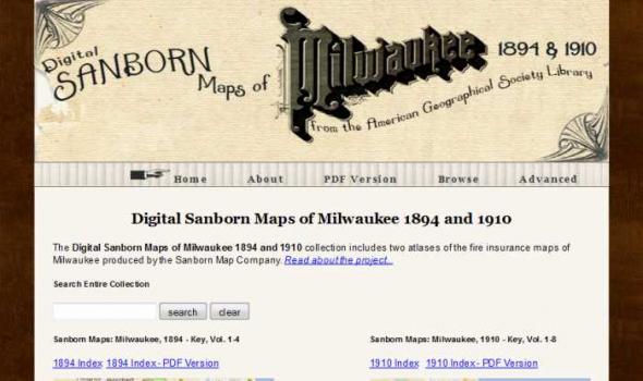
Scope and Content The Digital Sanborn Maps of Milwaukee 1894 & 1910 brings online 2 fire insurance atlases featuring detailed color maps of Milwaukee. Produced by the Sanborn Map Company, the 1894 atlas includes four volumes, consisting of 450 map sheets and the 1910 atlas includes eight volumes, consisting of 830 map sheets. Sanborn maps were designed to assist fire insurance agents with insuring property. Produced for over 12,000 urbanized areas in the United States, Sanborn maps have been described by the Library of Congress as "the single most important record of urban growth and development in the United States during the past one hundred years." Sanborn maps are excellent historical resources for academic, professional and personal needs.
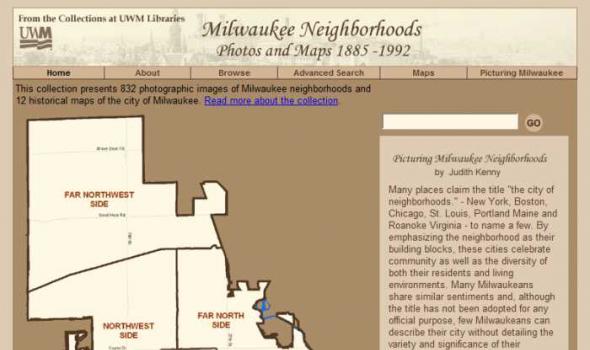
About the Collection Milwaukee and Art Work of Milwaukee Milwaukee Neighborhoods: Photos and Maps 1885 - 1992 presents images of Milwaukee neighborhoods from the Far Northwest Side to the Far South Side. The selection of images is limited by the current boundaries of the city of Milwaukee. The digital collection provides a visual documentation of the development of the city of Milwaukee from the mid-1880s to the early 1990s. It includes images of residential and industrial facilities, local businesses, historic buildings, churches, and numerous Milwaukee parks.
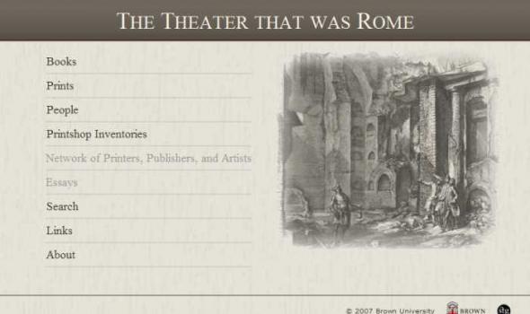
The Theater that was Rome About From the sixteenth through the eighteenth centuries, when the books, maps and single sheet prints that appear on this web site were made, Rome presented itself as a theater of the most advanced engineering feats of the period, as well as of the technological skills to execute and record the decorative programs that went with them. Maps of the city in its new guise as the powerful center of Christendom also documented the growth of curiosity about its antique history and pagan past, displaying all the forms of cartographic knowledge available throughout the period.
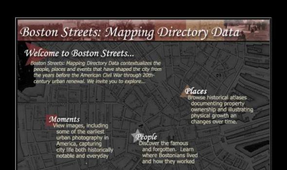
Visit Cowpaths (opens a new window) View all Boston Streets images (Using the Tufts Digital Library) Browse all Boston city atlases (Using the Tufts Digital Library) The Project: Boston Streets: Mapping Directory data was developed by the Digital Collections and Archives, Tufts University, with support from a National Leadership Grant from the Institute of Museum and Library Services . Additional support was provided by Docema, The Bostonian Society , and other anonymous gifts. The Bostonian Society provided more than 3000 images to the project and was also a major partner in developing descriptive cataloging specifications.
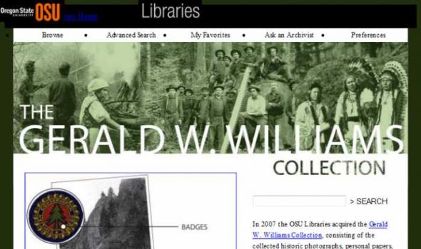
The Gerald W. Williams Collection In 2007 the OSU Libraries acquired the Gerald W. Williams Collection , consisting of the collected historic photographs, personal papers, and research library of Gerald "Jerry" Williams, former national historian for the U.S. Forest Service. Williams, a native Oregonian, spent much of his Forest Service career in the Pacific Northwest, prior to being appointed national historian in 1998. This digital collection includes some of the best imagery from the Williams Collection, including photos of the WWI era Spruce Production Division , logging photos of northwest Oregon taken by John Fletcher Ford , photos of Celilo Falls taken in 1956 by Jack Williams, and photos of depression era Civilian Conservation Corps camps and activities.

About Oregon Maps The University of Oregon Libraries and the Oregon State University Libraries present the Oregon Maps online collection in celebration of Oregon's sesquecentennial. Whether traveling city streets and country roads, or observing forests and farms from an airplane window, the patterns of the landscape have come to resemble the maps we draw. As European settlers populated Oregon, Western traditions of cartography came as well. One hundred and fifty years later, the Jeffersonian survey grid is imprinted in everyone's mind as most of Oregon's roads and property boundaries have been drawn on top of our Public Land Survey System. Maps are not simple representations of the world.
Oregon Explorer is a comprehensive digital library of Oregon's natural resources. This state-of-the-art, Web-based resource uses advanced information technology to access and integrate data from state and federal agencies, local governments, university scientists, citizens, and K-12 educators and students. It supports informed decisions and actions by people concerned with Oregon's natural resources and environment.
Through a series of geographic, data and topic-based Web portals, Oregon Explorer helps users:


